File:AL FARAS AL KAMIL RolandLaffitte map.jpeg
From All Skies Encyclopaedia
No higher resolution available.
AL_FARAS_AL_KAMIL_RolandLaffitte_map.jpeg (452 × 448 pixels, file size: 47 KB, MIME type: image/jpeg)
Summary
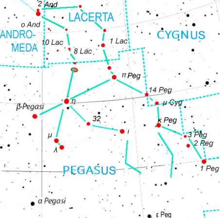
al Faras al Kamil, as_Sufi's "Complete Horse" mapped to the boundaries of modern IAU-constellations; Laffitte (2025).
Licensing
| This work is licensed under the Creative Commons Attribution 4.0 License. |
File history
Click on a date/time to view the file as it appeared at that time.
| Date/Time | Thumbnail | Dimensions | User | Comment | |
|---|---|---|---|---|---|
| current | 10:20, 13 May 2025 | | 452 × 448 (47 KB) | Sushoff (talk | contribs) | al Faras al Kamil, as_Sufi's "Complete Horse" mapped to the boundaries of modern IAU-constellations; Laffitte (2025). |
You cannot overwrite this file.
File usage
The following page uses this file: